

Insight · Natural Hazards
What does wildfire exposure mean for southern Europe?
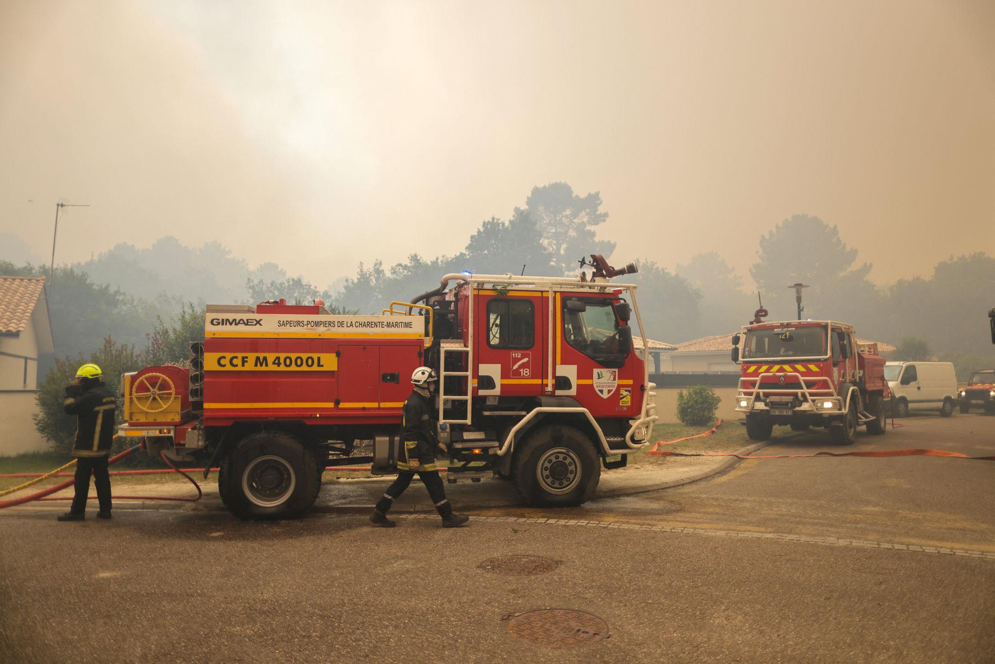
The 2026 wildfire season in southern Europe was a territorial event, not only a civil-protection one. Fire took land that farms, timber, plants and logistics actually use — and it closed the approaches to cities that planning still treats as safe hinterland. Spain, Italy and Greece carried the Mediterranean load. The fire that showed how close the season now sits to a working metropolis ran through the pines of Gironde and almost reached Bordeaux.
What burned — and what that surface is
By mid-September, European satellite mapping had recorded about 669,000 hectares burned in the EU: nearly twice the twenty-year average, though still below the record year of 2025. Hectares are not an ecological footnote. They are the fields that miss a harvest, the forest that will not yield for a generation, and the belt of access that closes around the perimeter.
Spain took the largest share. National figures put forest area affected at about 255,000 hectares by mid-August; satellite mapping was closer to 300,000. One blaze near Niebla, in Huelva, exceeded 33,000 hectares. Insured farmland already exceeded 15,800 hectares across 41 provinces, mainly cereal — the second-worst agricultural fire year of the decade after 2025.
Italy burned grassland and farms as much as forest. By late August the mapped area had passed 95,000 hectares, about twice the long-term average. Sicily, Calabria and Puglia held about three-quarters of the national total. Sicily was the centre of gravity: a mid-August regional estimate put damage at about €629 million — some €159 million of it on farms, €50 million on buildings, businesses and infrastructure — later projected toward €700 million. Greece burned on the order of 30,000 hectares. A fire that started in Viotia at the end of July ran toward Megara, on Athens’ western approach — another closed corridor on the capital’s edge.
Farms, plants and the corridor
Agriculture is hit twice: the crop that burns, and the harvest that cannot proceed while machinery is stopped and people are evacuated. Spain’s agricultural insurers expect a little over €2 million in fire compensation — the insured slice of field damage, not the full territorial cost. Sicily’s farm bill is two orders of magnitude larger. Forestry is slower: burned pine must be salvaged quickly or it is lost, and a massif-scale fire produces more wood than the local chain can take. Production and logistics fail around the fire, not only inside it. A site that does not burn still stops if the workforce is evacuated, the motorway is closed, or the rail is cut. Smoke cancels the tourist week and the cellar-door days that many wine estates now depend on. The operational question is which farms, mills, plants and crossings sit in the same fire domain and fail together.
The fires that almost reached Bordeaux
The season’s clearest territorial event was in Nouvelle-Aquitaine. From 22 July a fire that started at Saumos ran through the Landes de Gascogne pine forest: about 42,000 hectares in Gironde, the largest French wildfire since 1949. A second fire around Biscarrosse evacuated more than 30,000 people in the Landes. Together they produced the largest wildfire evacuation in modern France — about 220,000 people in Gironde, including communes on the outer ring of Bordeaux: Saint-Médard-en-Jalles, Le Haillan, Martignas-sur-Jalle, Saint-Jean-d'Illac, and the parts of Mérignac and Eysines beyond the ring road.
The fire did not take the city. It took the working belt west of it. The A63 toward Spain was closed for some 60 to 70 kilometres. Trains south of Bordeaux — Arcachon, Dax, Hendaye, Pau — were stopped until the start of August. Cap Ferret was emptied by road and by sea. At the peak of the holiday season, the state asked people not to come. That belt is also one of France’s densest aerospace and defence clusters: ArianeGroup, Dassault, Safran, Thales and Roxel, around Mérignac airport and Saint-Médard-en-Jalles. Sites were evacuated or ringed with firebreaks. The plants mostly did not burn. They still ceased to be ordinary places of work.
The valued bill is already on the table. The Bordeaux-Gironde Chamber of Commerce estimates about 40,000 businesses touched, 15,000 evacuated, some 200,000 jobs concerned, and about €200 million in losses. Insurers put claims from the Gironde, Landes and Var fires at nearly €500 million across some 25,000 files — including about €30 million of business interruption, mostly without a burnt building. The comparable insured total in summer 2022 was about €80 million. Forestry faces a salvage glut of 42,000 hectares of maritime pine. Vineyards were largely spared the flames; wine tourism was not.
Where the threat sits next
The 2026 map is no longer only Mediterranean. By late July the United Kingdom was running at about two and a half times its twenty-year burned-area average; Germany at more than twice. England and Wales logged more than a thousand vegetation fires, with notable burns in the New Forest, the Peak District and the Cairngorms. In the German Eifel, the Hürtgenwald fire became the largest in North Rhine-Westphalia in decades and forced thousands to leave; Belgium burned on the same border. The Netherlands, Poland and Norway also ran well above their usual activity. These are not Gironde-scale events yet. They are the same condition arriving in territories that still plan as if fire were a southern problem.
Wildfire exposure is the chance that a dry season closes a territory: the farm, the timber, the motorway, the plant and the city at the forest edge. 2026 showed that this is already an operating condition in Spain, Italy, Greece and, most sharply, on the western approaches to Bordeaux. The assessment that matters is which Central European and British landscapes now sit in the same picture.
Terranova Strategy
Territorial Exposure Assessment
Territorial Exposure Assessment places fire, farmland, access and industrial belts in the same territorial picture — so a closed corridor is visible before the next season.
Explore service